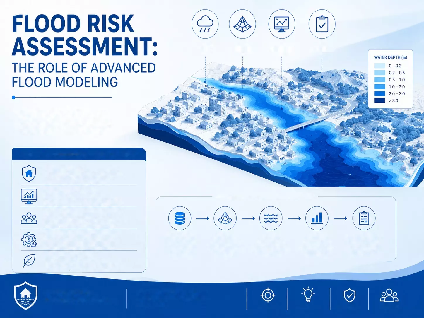
Flood Risk Assessment: The Role of Advanced Flood Modeling
Flooding is not always caused by extreme rainfall alone. Rapid urbanisation, poor drainage, changes in land use, reduced natural water storage, and development near rivers can all increase the impact of flood events.
As cities and infrastructure continue to expand, understanding where water may flow and which areas could be affected has become an important part of planning.
This is where advanced flood modeling plays a major role. By combining rainfall data, terrain information, drainage characteristics, river conditions, and other environmental factors, flood models can help create a clearer picture of potential flood behaviour.
The results can support better planning, infrastructure design, emergency preparedness, and long-term risk reduction.
What Is Flood Risk Assessment?
Flood Risk Assessment is the process of identifying areas that may be exposed to flooding and understanding the potential consequences for people, buildings, infrastructure, agriculture, and the environment.
A proper assessment does not simply ask whether an area can flood. It also considers factors such as the expected depth of water, flow velocity, duration of flooding, drainage capacity, land elevation, and the presence of vulnerable assets.
This information can help planners and project developers understand potential risks before construction begins. It can also support decisions related to drainage systems, roads, bridges, residential development, industrial areas, and other infrastructure.
Why Advanced Flood Modeling Is Important
Traditional flood assessment methods often depend on historical records and basic site observations.
While these sources remain useful, modern flood modeling can provide a more detailed understanding of how water may behave under different scenarios.
Advanced models can simulate rainfall-runoff processes, river flows, drainage behaviour, and water movement across a landscape. Different rainfall intensities or flood events can be modelled to understand how the affected area may change.
This scenario-based approach is particularly useful because flood behaviour can vary significantly depending on rainfall intensity, duration, terrain, soil conditions, and existing drainage infrastructure.
The Role of Hydraulic Modelling
Hydraulic Modelling is an important component of modern flood studies. It focuses on how water moves through rivers, channels, drainage networks, floodplains, and other pathways.
Using terrain and flow-related information, hydraulic models can estimate parameters such as water depth, flow velocity, and the direction of water movement. These outputs can help identify locations where water may accumulate or where high flow velocities could create additional hazards.
For infrastructure projects, hydraulic modelling can provide useful information for evaluating bridges, culverts, drainage systems, embankments, roads, and other structures.
How Hydraulic Models Support Planning
Hydraulic simulations can be developed for different flood scenarios. For example, a model may examine the expected impact of a moderate rainfall event and compare it with a more extreme event.
The comparison can highlight how quickly flood conditions may change and which areas require additional protection or improved drainage capacity.
This allows engineers and planners to consider flood resilience during the design stage rather than responding only after a flood occurs.
Understanding Flood Inundation Mapping
Flood inundation mapping provides a visual representation of areas that may become covered by floodwater under specific conditions. These maps can show the possible extent and depth of flooding across a particular region.
Instead of relying only on numerical information, inundation maps make flood risk easier to understand. They can show how a flood may spread across low-lying areas, roads, agricultural land, settlements, or infrastructure.
How Flood Inundation Maps Are Used
Flood inundation maps can support urban planning, disaster management, infrastructure development, and emergency preparedness.
For example, planners can compare proposed development locations with modeled flood-prone zones. Emergency authorities can also use flood maps to understand which roads or settlements could potentially be affected during severe rainfall events.
The accuracy of these maps depends on the quality of the underlying data, including terrain models, rainfall information, river characteristics, drainage conditions, and land-use data.
The Importance of Catchment Analysis
Before understanding where floodwater will go, it is important to understand where that water comes from. This is the purpose of Catchment Analysis.
A catchment is an area from which rainfall and surface runoff drain toward a common outlet, such as a river, stream, lake, or drainage point. Studying the catchment helps identify how rainfall is collected and transported through the landscape.
Catchment analysis may consider terrain slope, drainage patterns, soil characteristics, land use, rainfall, vegetation, and surface conditions. These factors influence how much rainfall becomes surface runoff and how quickly that runoff reaches downstream areas.
Connecting Catchment Analysis With Flood Modeling
Catchment analysis and hydraulic modeling work together to provide a more complete understanding of flood behaviour.
Catchment analysis helps estimate how water is generated and reaches a particular location, while hydraulic modeling helps determine how that water moves through channels, floodplains, and drainage systems.
When these datasets are combined, flood studies can provide more useful information for understanding both upstream runoff and downstream flood impacts.
How Technology Is Improving Flood Risk Studies
Modern flood studies increasingly use Geographic Information Systems, remote sensing, digital elevation models, satellite imagery, rainfall datasets, and computational modeling.
Digital terrain data can help identify low-lying areas and natural drainage paths. GIS technology can then combine multiple datasets to create detailed flood-risk maps.
Remote sensing and satellite imagery can also support land-use analysis and help identify changes in built-up areas, vegetation, water bodies, and other surface features.
The integration of these technologies makes it possible to analyse large areas more efficiently and develop scenario-based flood assessments.
Supporting Better Infrastructure Decisions
Flood modeling is particularly valuable during the planning and design of infrastructure projects. Roads, bridges, residential developments, industrial facilities, drainage systems, and public utilities can all be affected by flood conditions.
A detailed flood study can help identify potential risks at an early stage. This gives project teams an opportunity to consider drainage improvements, suitable elevations, protective structures, alternative layouts, or other mitigation measures.
The objective is not necessarily to eliminate every flood risk. Instead, the goal is to understand the risk clearly and incorporate appropriate measures into project planning.
Building More Resilient Communities
Flood risk cannot always be completely avoided, particularly in regions exposed to intense rainfall or located near rivers and natural drainage systems. However, better information can improve preparedness and decision-making.
Advanced flood modeling provides a way to examine possible scenarios before they happen.
When combined with effective drainage planning, land-use management, emergency preparedness, and appropriate infrastructure design, it can contribute to more resilient communities.
Conclusion
Flood risk management is becoming increasingly important as urban areas expand and weather patterns create new challenges for infrastructure and communities. Flood risk assessment, Hydraulic Modelling,
Flood Inundation Mapping, and Catchment Analysis provide complementary tools for understanding how flooding can develop and which areas may be affected.
By combining reliable data with modern modeling techniques, planners, engineers, and decision-makers can move from reacting to flood events toward preparing for them.
A detailed understanding of flood behaviour can ultimately support safer infrastructure, more informed development, and stronger long-term flood resilience.
FAQs
What is the main purpose of flood risk assessment?
The main purpose of flood risk assessment is to identify areas that may be exposed to flooding and understand the possible effects on people, infrastructure, property, agriculture, and the environment.
How does hydraulic modelling help with flood management?
Hydraulic modelling helps simulate how water moves through rivers, channels, drainage systems, and floodplains. It can provide information about potential water depth, flow direction, and velocity under different flood scenarios.
What is flood inundation mapping?
Flood inundation mapping is the process of creating maps that show areas that could potentially be covered by floodwater under specific rainfall or river-flow conditions. These maps can help with planning and emergency preparedness.
Why is catchment analysis important?
Catchment analysis helps determine how rainfall is collected and converted into surface runoff within a drainage area. Understanding these processes can improve the assessment of how water may reach rivers, drainage systems, and downstream locations.
Can flood modeling help infrastructure projects?
Yes. Flood modeling can help identify potential flood exposure during the planning and design of roads, bridges, buildings, drainage systems, industrial facilities, and other infrastructure. This information can support better site planning and flood-resilience measures.